Jamaica is the largest of the English-speaking islands of the Caribbean with an area of 4,411 square miles. The island measures 243 km from east to west (Morant Point to Negril) and 80 km at its widest point from St Ann’s Bay in the north to Portland Point on the south coast.
Three main elements make up the island’s geography:
- The internal mountain ranges formed by igneous and metamorphic rocks dating from the period of tectonic activity
- The limestone hills and plateaus formed during the deposits of calcium carbonate associated with the karst limestone hills of the Cockpit country
- Interior valleys and coastal plains formed by relatively recent erosion.
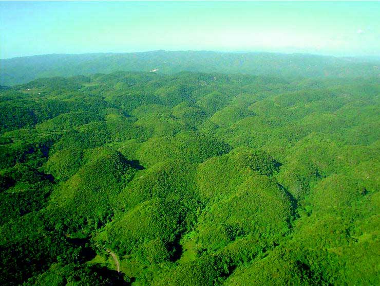
Together, these complex processes give Jamaica the appearance of the famous ‘sheet of crumpled paper’ described by Christopher Columbus.
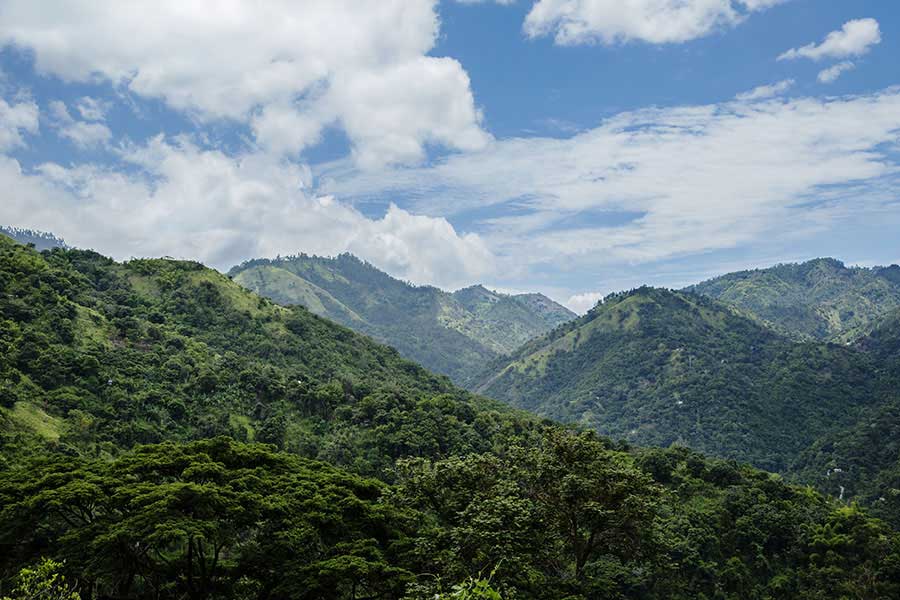
Much of Jamaica is hilly and the highest mountains occur towards the east running westwards forming the backbone through the middle of the island. From the east there are the magnificent Blue and John Crown Mountains now a UNESCO World Heritage site rising to 2,250 meters or 7,402 feet; the central range runs from Stony Hill to the Cockpit Country and the western range extend through Westmoreland and Hanover of which the main peaks are the Dolphin Head Mountains.
Since the principal mountain ranges run east to west, the rivers which start on their slopes generally flow from north to south. Most are not navigable because they tend to run swiftly, and their courses are often broken by waterfalls. The Black River is the longest navigable with 28 km of the total 73km of its length being navigable for small vessels. The Rio Grande rising on the northern slopes of the Blue Mountains is a large river famous for rafting. Other important rivers are: Wag Water rising in St Andrew and flowing through St Mary; Hope River rising in Newcastle and ending in Kingston; Rio Cobre in St Catherine; Milk River in Clarendon; Martha Brae in Trelawny, the Cabaritta in Westmoreland and the Yallahs and Plantain Garden in St Thomas.
Being located in the tropical zone, Jamaica has a generally hot and sunny climate. Because the island is mountainous, temperatures vary between areas of high and low elevation but there are no extremes. The mean annual temperature is around 80 degrees F and rarely rises beyond the low to mid 90s.
Traditionally Jamaica has two rainy seasons – May and October but with the effect of global warning these traditional patters have become unpredictable with long extended periods of drought alternating with periods of torrential rainfall. The eastern end of the island and the parish of Portland gets the heaviest rainfall which accounts for its lush vegetation while the southern Pedro Plains tend to be the driest.
Jamaica is in the hurricane belt which means the island is susceptible to tropical cyclones that are often generated in the vicinity of the Cape Verde Islands between June and October. Their effect can be quite devastating to human lives animals, crops, building and physical infrastructure resulting from high winds and unusually heavy rainfall.
Administratively, Jamaica is divided into 14 different parishes each administered by an elected council whose Chairman is the Mayor of the capital of the parish. Kingston and St Andrew are joined administratively as one parish with a single corporation and mayor.